Title of Productivity and Innovation Initiative
Guagua Geographic Information System (GGIS)
Implementing Agency
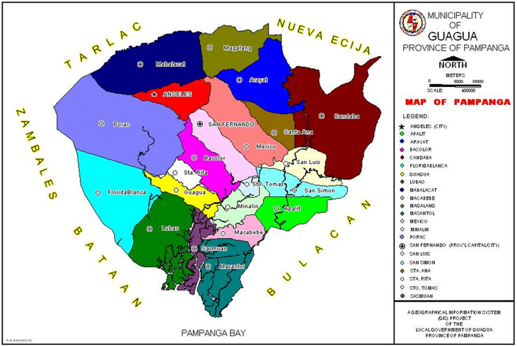
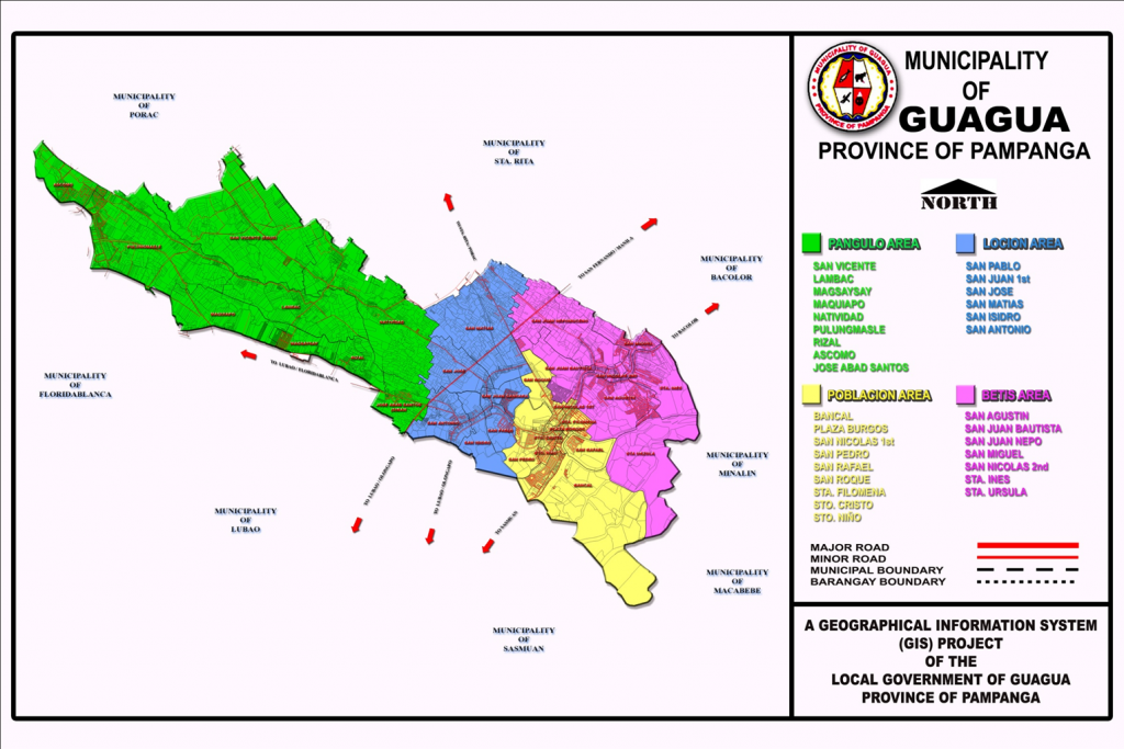
Municipal Government of Guagua, Pampanga
Year Implemented
1997-Present
Themes
Management for Productivity, Quality and Agility, Digitization & New Technologies, and Perspectives on Productivity, Governance, and Development
General Description
The Municipal Government of Guagua is one of the first LGUs in Region III that started the development of a Geographic Information System (GIS.) Through the assistance of the Australian Agency for International Development (AusAID) and the Philippine Land Information System, the Guagua Geographic Information System (GGIS) project was first launched in 1997. The GGIS spatial maps and database is widely used in Comprehensive Land Use Planning (CLUP), local disaster risk management, traffic management, and the administration of tax programs such as land valuation and land use. At present, it is continuously being updated by the Office of the Municipal Planning & Development Coordinator (MPDC).
Background and Problem
The geographic location of the Philippines makes it a disaster-prone country, as it regularly faces natural hazards such as typhoons, flash floods, landslides, earthquakes, and volcanic eruptions. This state of affairs is expected to intensify in severity and impact in the coming years due to climate change, continually hampering the economic development of the country and causing widespread destruction of resources and property. The 1991 eruption of Mount Pinatubo in particular has taken a serious toll on the people of central Luzon, displacing more than 10,000 families and dramatically altering the landscape of the area, thus necessitating an updated mapping system for preventive planning and action.
The Municipal Government of Guagua, Pampanga, is located along the Pasig Potrero River Control System (PPRCS), one of Mount Pinatubo’s main river channels, thus making the residents vulnerable to any further volcanic activity. Apart from this, land tax management, such as determining the exact figure area, is also one of the challenges since the municipality has over 10,000 parcels in just 4,875 hectares.
Solution and Impact
At present, the most frequent use for GGIS is to provide land developers and property owners with land use information, as these form the basis for property rights. The usual requested information varies in terms of property location, dimension, existing owners’ name, property rights, previous owners, missing and erroneous lots, values, and many other categories of spatial data. This removes the need to do research at the Land Management Services (LMS) since most data are available in the municipal office.
The GGIS can also be used to provide efficient and accurate tools for collecting, storing, retrieving, reporting, and displaying public information. The passage of a Sangguniang Bayan Ordinance through the local revenue code to collect minimum fees has helped augment the research activities of the MPDC Office.
For disaster response, thematic GIS mapping serves as an important tool to identify flooded barangays, risk areas, affected utilities, road accessibility, and possible lifelines and exit routes. In regular disaster preparedness activities, data are likewise presented in GIS format, making the discussions and planning more accurate and visually understandable.
To address resource and land use issues, GGIS is utilized to identify and analyze the development of the town’s land resources, support the preparation of land use plans for environmental regulatory programs, determining the best location for the proposed environmental projects such as landfills and material recovery facilities, identifying lots for reclassification purposes, capturing lot data for tax assessment and identification, maintaining property records, zoning, traffic management and rerouting, and tracking down encroachments, particularly along river channels.
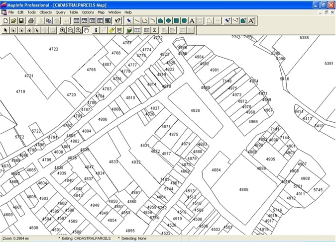
The applications of GGIS for Guagua have also expanded to include land registration and cadastre, transportation, risk management, resource, and land use issues in the local government functions. The area of land registration and cadastre is one of the most interesting areas in the use of GGIS and Land Information System.
Milestones
Out of a total of 108 LGU-initiated programs that participated in the 2020 Digital Governance Awards, the Department of the Interior and Local Government recognized 15 LGUs for making significant changes to improve their public service delivery amid the COVID-19 pandemic. The Municipality of Guagua, Pampanga was the champion under the category Best in LGU Empowerment (G2G) for GGIS.
To date, the GIS unit is housed in the MPDC office. Although the GIS project is not a priority of the administration, data collection and encoding are continuously undertaken despite the limited funds. The office has coordinated with the Lands Management Bureau RO3 to acquire photocopies of new subdivision lot plans and with the Registry of Deeds RO3 to provide copies of all new approved titles. Although it is not equipped with a plotter, the office could produce 1:4,000- and 1:2,000-scale maps of the town by printing them in regular bond papers then cutting and connecting all the portions. These scaled, hardcopy maps are used to identify missing lot data, overlapping lots, and barangay boundaries with much or reasonable accuracy.
At present, 98 percent of all lot data, subdivision lot plans, and mother titles have already been encoded. With almost completed spatial data, the identification of barangay boundaries is being undertaken, based on existing cadastral lot boundaries, mapping boundaries, and Transfer Certificates of Titles. Since these three show different barangay boundaries, the concerned barangay councils are encouraged to negotiate amiably on the issue of barangay boundaries.
References
Bautista, C.B. (1999, October 06). The Mount Pinatubo Disaster and the People of Central Luzon. USGS Publications Warehouse. https://pubs.usgs.gov/pinatubo/cbautist/
Chavez, C. (2020, December 15). DILG Commends 15 LGUs for their digital governance solutions. ManilaBulletin. https://mb.com.ph/2020/12/15/dilg-commends-15-lgus-for-their-digital-governance-solutions/
Municipality of Guagua. (2010). Guagua Geographic Information System (GGIS) 2010. https://fdocuments.in/reader/full/guagua-clup
Vincenzo Bolletino et al., (2018). Perceptions of Disaster Resilience and Preparedness in the Philippines. Harvard Humanitarian Initiative. https://hhi.harvard.edu/publications/perceptions-disaster-resilience-and-preparedntess-p